Know the Rules/Fishing Regulations/Marine Managed Areas/Hawai‘i Marine Life Conservation Districts/Hanauma Bay

O‘ahu - Hanauma Bay Marine Life Conservation District (MLCD)

Style A Carousel

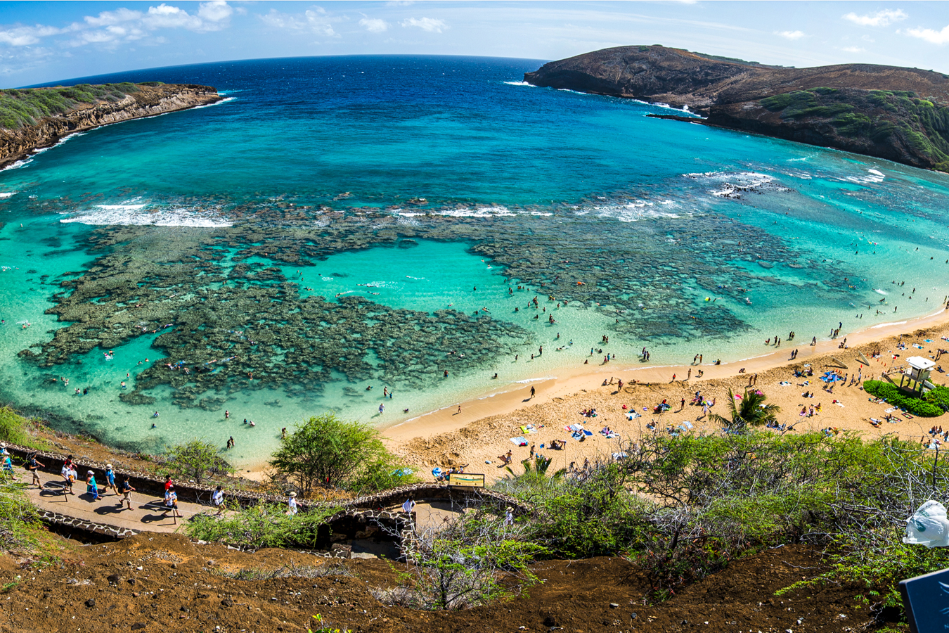
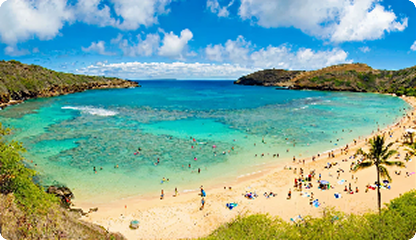
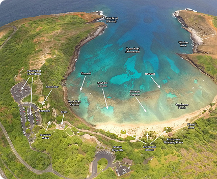
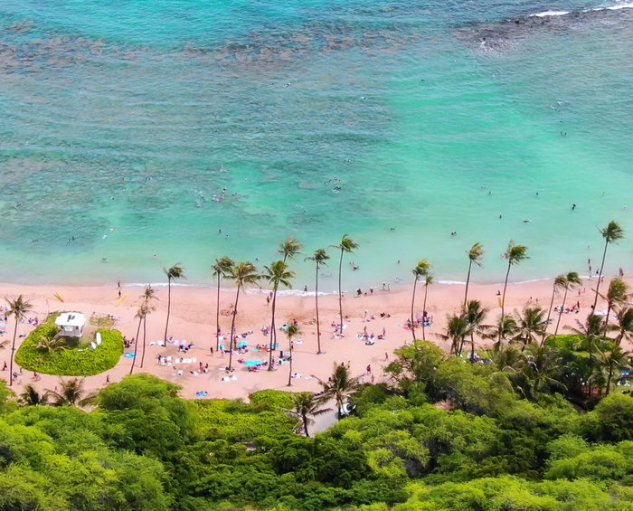
Nestled below the slopes of Koko Head on O‘ahu’s southeast coast, Hanauma Bay is one of Hawai‘i’s most iconic natural preserves—just about 25 minutes from Waikīkī. Formed by two adjoining volcanic craters and shaped over time by waves and erosion, the bay is now a protected sanctuary for coral, fish, and other unique marine life.

Getting There & Visitor Information

Hanauma Bay is located off Kalaniana‘ole Highway (Hwy 72). Limited parking is available on the ridge above the bay. Public bus service runs daily, while taxis and ride-hail drop-offs are discouraged due to traffic and safety considerations.

Hours:

  • Open to the public Wednesday–Sunday.
  • Entry allowed 6:45 a.m. – 1:30 p.m.
  • Beach cleared at 3:30 p.m.
  • All visitors must exit by 4:00 p.m.

Hours and operations may change. For the most current entry times, admission fees, and updates, visit the City & County of Honolulu’s Hanauma Bay website or call (808) 768‑6861.

MLCD Boundaries

Hanauma Bay MLCD extends from the highwater mark out seaward to an imaginary line drawn across the mouth of the bay—from Palea Point to Pai‘olu‘olu Point on the opposite side.

Geology & History

Hanauma Bay was created by two of the many craters that formed Koko Head. The outer section of the bay is one crater, while the inner cove is the remnant of a second. Over centuries, waves eroded the seaward walls of these craters, carving the bay’s current shape.

Features of note:

  • Wave‑cut benches run along both sides of the bay just above sea level.
  • Green olivine minerals are mixed throughout the beach sand, leaving distinctive green streaks near the shoreline.
  • The bay was a favored fishing ground of King Kamehameha V and a retreat for Hawaiian royalty.

Marine Environment

Inner Reef

A shallow fringing reef begins just offshore with depths up to 10 feet. The reef flat stretches roughly 100 yards out, and has several large sandy patches sprinkled throughout the area.

Visibility is often best early in the day and during low tide, before sediment is stirred up by snorkelers.

Channel & Outer Reef Flat

A dredged channel near the center of the bay—originally created for undersea telephone cables—offers swimmers a safe passage to the outer reef flat.

Here you’ll find:

  • Healthy coral beds, especially toward the bay’s right side
  • Abundant schooling fish
  • Common sightings of honu (Hawaiian green sea turtles)
  • Depths to about 30 feet with good visibility most of the time

Outer Bay

Recommended only for experienced swimmers and divers, this region reaches depths of about 70 feet and contains a large finger coral reef along the left side. Visibility is often the clearest here compared to any other area of Hanauma Bay.

Safety Considerations

Certain areas may be hazardous, especially during high surf or rough conditions:

  • Witches’ Brew: a small peninsula and cove on the right side of the bay
  • Toilet Bowl (Queen’s Bath): a small pool around the left point
  • The bay was a favored fishing ground of King Kamehameha V and a retreat for Hawaiian royalty

Additional hazards:

  • Rip currents an be strong in the channel or around the entrances, especially during falling tides
  • The Moloka‘i Express, a powerful current near the left side of the bay’s mouth, can also be dangerous
  • Wave‑cut benches become slippery and hazardous during large surf

Lifeguards are stationed year‑round.

Facilities

Amenities include:

  • Restrooms
  • Showers
  • Lockers
  • Emergency and pay phones
  • Snack bar
  • Snorkel and life vest rentals
  • Parking lot

For more information about visiting and admission, please visit the Hanauma Bay State Park website

Hanauma Bay State Park – Hours • Pricing • Activities

Regulations

Permitted Activities

  • Carrying a small knife for personal safety
  • Conducting scientific or propagation activities with a valid permit

Prohibited Activities

  • Fishing for, taking, injuring, or possessing any marine life, including eggs
  • Possessing any equipment used to take marine life
  • Removing or altering sand, coral, rocks, or other geological features
  • Possessing any equipment that may be used for geological collection or alteration
  • Feeding or introducing any substance into the water to attract marine life
  • Operating any watercraft within the MLCD

Want to learn more?

Explore Hawaiʻi’s Marine Managed Areas by island, including rules, boundaries, and stewardship details.

Honolua Bay
Photo: DAR