Know the Rules/Fishing Regulations/Marine Managed Areas/Hawai‘i Marine Life Conservation Districts/ Mānele Hulopo‘e
Lāna‘i - Mānele–Hulopo‘e Marine Life Conservation District (MLCD)


- Lāna‘i — HAR 13‑30
- 309 acres | Established 1976
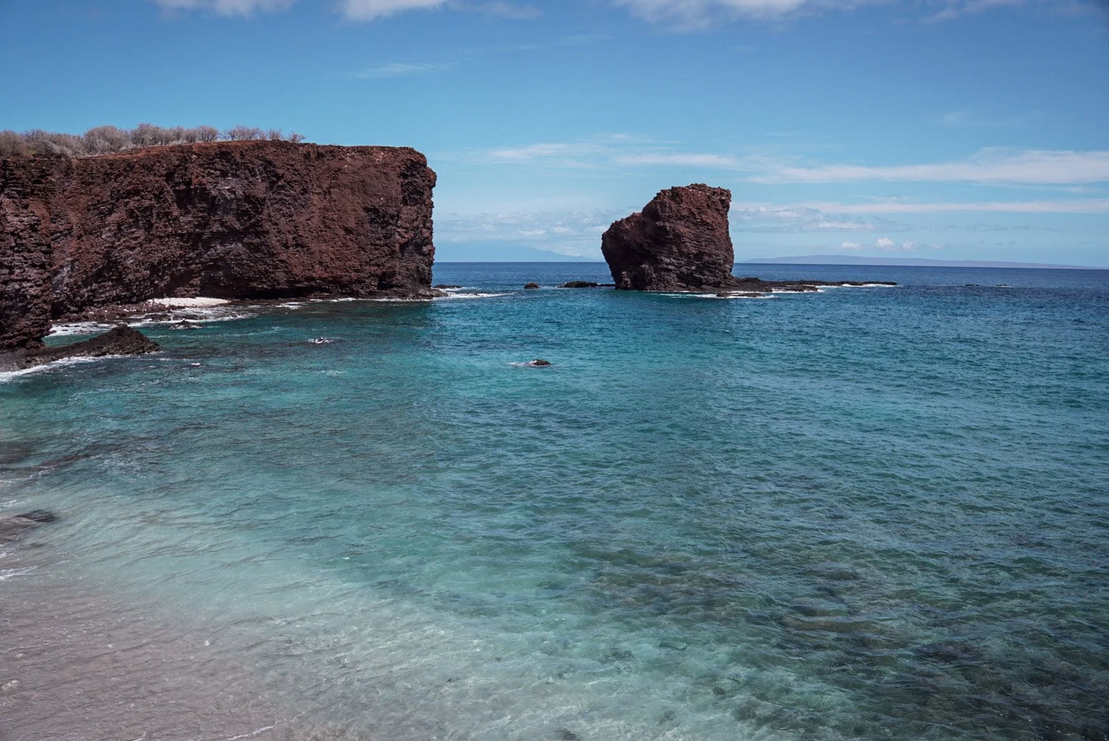
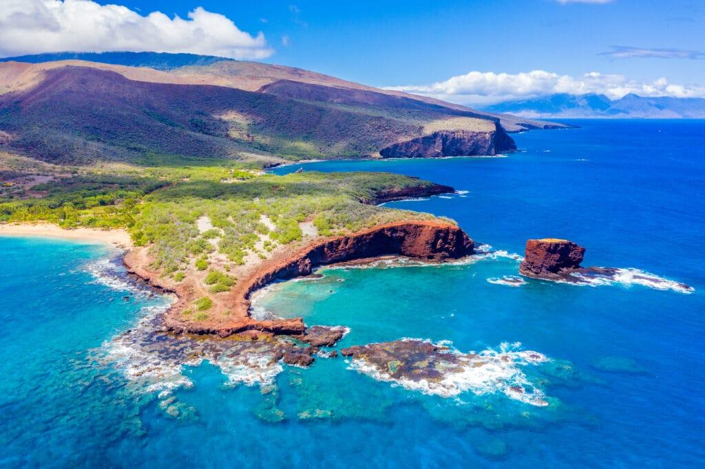
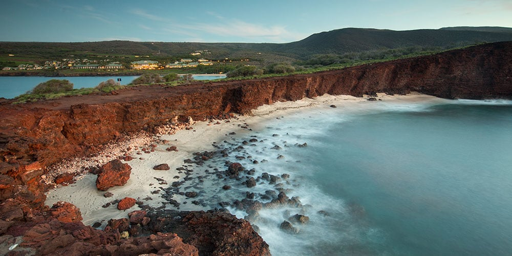
Located on the southern coast of Lāna‘i, the Mānele–Hulopo‘e MLCD encompasses two adjacent bays known for their scenic beauty, rich coral communities, and cultural history. The area is easily reached by driving 8 miles south from Lāna‘i City on Highway 441. Parking is available at both bays.
Visitors arriving by boat at Mānele Harbor can reach Hulopo‘e Bay via a pleasant 10–15 minute walk along the shoreline.
MLCD Subzones & Boundaries
The MLCD is divided into two subzones, each with its own regulations:
Subzone A
Extends from the highwater mark seaward to a line from:
- Kaluako‘i Point → Flat Rock → Pu‘u Pehe Rock
Subzone B
Extends from the highwater mark seaward to a line from:
- Pu‘u Pehe Rock → Kalaeokahano Point
These zones cover the marine areas around Mānele Bay, Hulopo‘e Bay, and the small cove between them.
Cultural & Geological Features
Mānele and Hulopo‘e are separated by a volcanic cone whose seaward edge has eroded into Pu‘u Pehe Cove—one of the island’s most striking natural features. The dramatic sea stack Pu‘u Pehe Rock rises just offshore and is home to rich marine life below the surface.
Remnants of the ancient fishing village of Mānele extend from near Mānele Small Boat Harbor to Hulopo‘e Beach Park, reflecting centuries of traditional Hawaiian coastal living.
Marine Environment
Mānele Bay
- Corals are most abundant along the sides of the bay near the cliffs.
- The bottom drops quickly to about 40 feet.
- The middle of the bay forms a sandy channel.
- Just outside the western edge near Pu‘u Pehe Rock is “First Cathedrals,” one of Lāna‘i’s premier SCUBA dive sites.
Hulopo‘e Bay
- Features large tidepools near its left point.
- A shallow reef just offshore provides excellent snorkeling.
- Calm, clear water makes this one of Lāna‘i’s most popular beach and snorkel destinations.
Pu‘u Pehe Cove
- Known for its crystal-clear water and vibrant marine life.
- Coral grows interspersed with sand patches.
- Best coral is found in 10–15 feet of water, slightly offshore from the small beach.
Safety Considerations
- All areas within the MLCD can experience dangerous swells and currents during southern (kona) storms.
- Pu‘u Pehe Cove access is hazardous—steep cliffs, unstable footing, and loose lava pose serious risks.
- Mānele Bay has frequent boat traffic; swimmers should stay aware of vessels.
Facilities
Available at Mānele and Hulopo‘e:
- Restrooms
- Showers
Regulations
Permitted Activities
-
- Fishing for or taking finfish or ‘a‘ama crab by pole‑and‑line from the shoreline only.
- Possessing in the water:
- Pole‑and‑line
- One knife
- One hand net (frame ≤ 3 ft diameter, excluding handle)
- Legal fishing gear on vessels transiting to/from Mānele Harbor (gear may not enter the water)
- With a permit:
- Bagging and removing akule netted outside the MLCD, transported only over sandy bottom areas
- Conducting scientific, propagation, or other approved activities
Prohibited Activities
- Fishing for, taking, or injuring any marine life, including eggs—except as listed above.
- Taking or altering sand, coral, rock, or any geological feature.
- Operating, anchoring, or mooring any vessel within Subzone A.
- Exception: manually‑propelled Hawaiian outrigger canoes (operation only—no anchoring or mooring).
- Operating, anchoring, or mooring any vessel in a way that damages marine life or geological features anywhere in the MLCD.