Know the Rules/Fishing Regulations/Marine Managed Areas/Hawai‘i Marine Life Conservation Districts/Pūpūkea
O'ahu - Pūpūkea Marine Life Conservation District (MLCD)
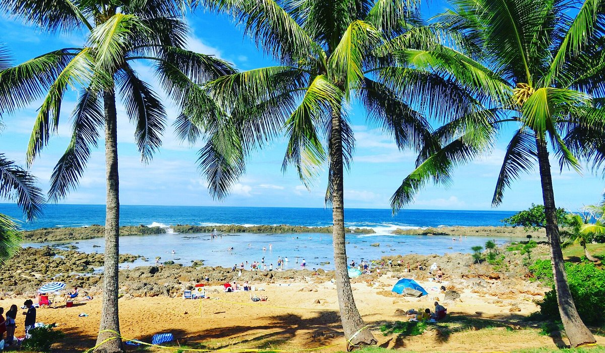
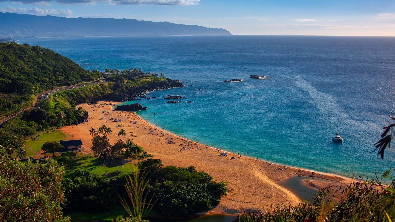
Located along O‘ahu’s famed North Shore, the Pūpūkea MLCD spans the offshore waters of both Pūpūkea Beach Park and Waimea Bay Beach Park, separated by a small residential section of Waimea town.
MLCD Boundaries
The Pūpūkea MLCD encompasses the ocean area from the highwater mark seaward:
- 100 yards off Kulalua Point (northern end of Pūpūkea Beach Park).
- then south to the most seaward exposed rock of the Wananapaoa Islets at the south side of Waimea Bay (including the islets),
- then back to shore on a southeast line.
This zone includes Kapo’o (Shark’s Cove), Kalua o Maua (Three Tables), and the surrounding offshore waters.
Marine Features & Recreation Areas
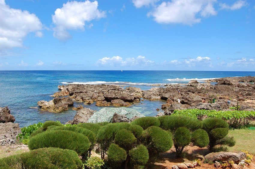
Kapo’o (Shark’s Cove)
At the northern end of the MLCD, Kapo’o is one of the most popular snorkeling and SCUBA sites on the island. While shallow inside the cove, depths increase to about 20 feet near the mouth, with deeper diving just outside.
Notable features include:
- Caves and lava formations near the northwest point
- Additional caves stretching south of the cove
- Excellent night diving to the left of the cove
- A sloping reef bottom reaching 45 feet outside the cove
- Tidepools with schools of fish that are popular for snorkeling during high tides
Visibility is often limited inside but improves rapidly once outside the cove. Despite the name, shark presence here is no greater than anywhere else on the North Shore.
Kalua o Maua (Three Tables)
In the middle of the MLCD is Kalua o Maua or Three Tables, which gets its name from the three flat sections of reef exposed during low tides. The area is known for:
- Good snorkeling around and beyond the reef tables
- Diverse ledges, arches, and lava tubes offshore
- Water depths of about 15 feet near shore, with prime diving between 30–45 feet
Waimea Bay
Popular for swimming and best known for its legendary winter surf, Waimea Bay is mostly sandy bottom but does feature some areas of coral- particularly off the rocky point on the right side in about 20 feet of water.

Safety Considerations
Conditions vary dramatically with the seasons:
- May through October: generally calm, though surge is still possible
- Winter months: surf and currents can become extremely dangerous throughout the MLCD, including tidepool areas
Additional notes:
- Lifeguards are stationed at Waimea Bay
- No lifeguards are present atKapo‘o and Kalua o Maua
- A fire station is located between the tidepools and Kalua o Maua area for emergency response
Facilities
Amenities include:
- Restrooms
- Showers
- Parking lots
Regulations
Permitted Activities
- Hand-harvesting up to two pounds (combined total, squeezed dry) of limu kohu and limu lipe‘epe‘e, provided the holdfast remains attached.
- Possessing a knife for personal safety.
Within Waimea Bay only:
- Taking and possessing finfish from shore using hook-and-line only, with up to two poles per person, one line per pole, and two hooks per line.
- Taking and possessing ‘ōpelu during August–September, and akule during November–December, using legal nets.
Prohibited Activities
- Taking, harming, killing, possessing, or removing any marine life (including eggs), except where explicitly allowed.
- Taking or altering geological features such as rocks, sand, or coral.
- Possessing in-water gear that may be used to take marine life or alter geological features.
- Feeding or introducing substances into the water to attract marine life (other than permitted fishing activities in Waimea Bay).
- Snagging akule from the shore of Waimea Bay.