Know the Rules/Fishing Regulations/Marine Managed Areas/Hawai‘i Marine Life Conservation Districts/Molokini Shoal

Maui - Molokini Shoal Marine Life Conservation District (MLCD)

Style A Carousel
  • Maui — HAR 13‑31
  • Approx. 77 acres | Established 1977

Molokini is a striking crescent‑shaped islet located in the ‘Alalākeiki Channel, about 3 miles off Maui’s southwestern coast. Accessible only by boat, it is one of Hawai‘i’s most famous snorkeling and diving destinations. Charter boats depart regularly from Lahaina, Mā‘alaea Harbor, and Kīhei.

About the Islet

Molokini represents the southern rim of an extinct volcanic crater. The shallow, protected waters of the inner cove are the submerged floor of this crater.

Historically, the deeper waters surrounding the islet once supported abundant black coral, which was heavily harvested. Today, harvesting is restricted, and small colonies remain on the back wall.

Note: Molokini is a state seabird sanctuary. Entry onto the islet is prohibited.

MLCD Subzones & Boundaries

The MLCD consists of two subzones:

Subzone A — Inner Cove

Includes the cove area, bounded by a line from:

  • The end of the submerged ridge off Lalilali Point, to
  • Pahe‘e O Lono Point

Subzone B — Outer Waters

Extends 100 yards seaward of the islet and Subzone A, covering the outer perimeter and deeper offshore areas.

Marine Environment

Inner Cove

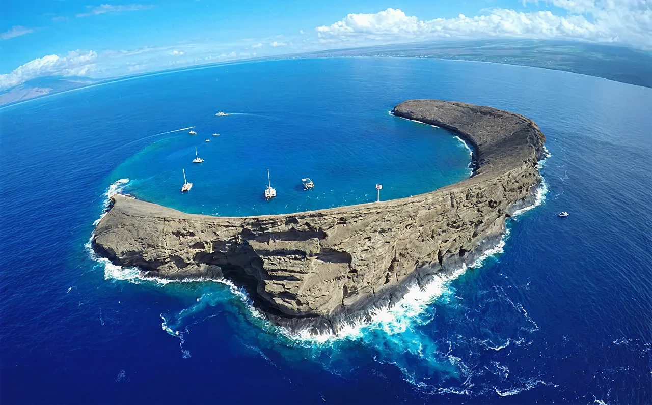
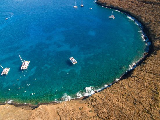
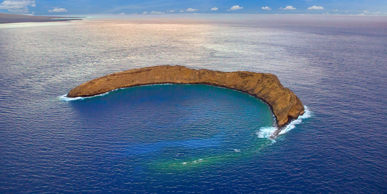
There is no sand beach on Molokini, and the shoreline gives way directly to the underwater landscape. Key features include:

  • A gentle slope from nearshore to about 100 feet deep
  • Bottom composed of sand patches, coral, and basaltic boulders
  • A shallow reef (< 30 feet deep) extending from the islet’s northwestern point

The cove shelters one of Hawai‘i’s most diverse marine ecosystems, with exceptionally clear water and abundant reef fish.

Humpback whales have even been seen entering the cove.

Back Wall (Southern Side)

  • Steep drop‑off exceeding 200 feet
  • Scattered patches of coral along the vertical face
  • Crevices and outcroppings that host large populations of fish

This area is popular among experienced divers due to its dramatic topography.

5179fd862e8937122bf44b5c1c592ca5da97d7dc

Safety Considerations

  • Currents outside the cove can be strong, and may intensify inside the cove during afternoon winds. months, often making conditions dangerous.
  • Divers exploring the back wall should monitor depth gauges carefully due to the steep drop‑offs.
  • There are no facilities on Molokini.

Facilities

  • None

Regulations

Permitted Activities

  • Fishing for, taking, or possessing finfish by trolling in Subzone B only.
  • Possessing in the water:
  • A knife
  • Shark billy
  • Bang stick
  • Powerhead
  • CO₂ injector
  • Conducting scientific, propagation, or other approved activities with a permit
  • Conducting commercial activities (excluding take of marine life) with a permit

Prohibited Activities

  • Fishing for, taking, or injuring any marine life (including eggs), except trolling in Subzone B.
  • Possessing any device that may be used to take marine life.
  • Removing or altering sand, coral, or any geological feature.
  • Feeding or introducing food or attractants into the water (except for trolling activities in Subzone B).
  • Mooring boats for commercial use without a permit.
  • Anchoring boats when a day‑use mooring system is established by the Department.
  • Landing on the islet (prohibited due to seabird sanctuary status).